











2GIS
Offline map & navigation

Description of 2GIS: Offline map & navigation
2GIS is a detailed mapping and navigation application designed for both car drivers and pedestrians. This app offers users the ability to navigate through cities, find addresses, and access a variety of essential information with ease. Available for the Android platform, users can download 2GIS to utilize its features offline, ensuring they can find their way even without an internet connection.
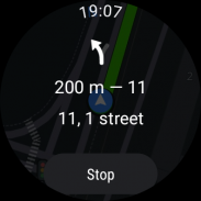
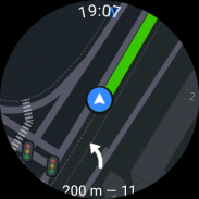
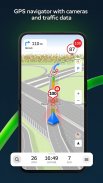
The application presents a robust GPS-navigation system that accounts for real-time traffic conditions, including traffic jams, speed cameras, and road types. Users can create routes between cities or set multiple waypoints to optimize their travel experience. The app also provides tailored navigation for trucks, taking into consideration the specific characteristics of the vehicle and its cargo.
2GIS includes a comprehensive directory of local businesses and services, allowing users to search for companies, phone numbers, operating hours, and the goods or services they offer. This extensive database helps users locate everything from restaurants to retail shops. The app displays detailed information about each business, including user-generated photos and reviews, which can assist in making informed decisions.
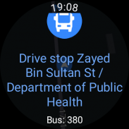
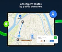
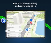
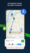
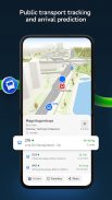
Public transport information is readily accessible through 2GIS. The application offers transit schedules and online routes, facilitating easier navigation across various modes of public transport. This feature is particularly useful for users who prefer to travel using buses or subways, as it provides real-time updates and directions.
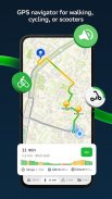
For those who enjoy exploring cities on foot, 2GIS provides pedestrian navigation. This function allows users to find walking routes effectively, with voice guidance available to enhance the navigation experience. The app operates in the background, ensuring that users can navigate without needing to actively monitor their device.
2GIS also introduces a unique feature for social connectivity. Users can track the real-time location of friends and family members on the map, making it easier to coordinate meet-ups or ensure safety. The application allows users to manage their visibility settings, deciding who can see their location.
In addition to its mapping and navigation capabilities, 2GIS serves as a travel guide. Users can discover local attractions, Wi-Fi hotspots, and other points of interest while exploring a new city. This feature allows travelers to enhance their experience by easily locating amenities that cater to their needs.
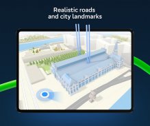
The app is designed to provide accurate maps, clearly displaying districts, streets, buildings, bus stops, and other important locations. Users can find specific entrances to buildings and nearby parking lots, which can be especially beneficial in busy urban environments. The detailed mapping ensures that users have all necessary information at their fingertips.
2GIS actively reports road events, including accidents and blocked streets, which helps users navigate around obstacles and choose the best routes. User comments about road conditions contribute to the reliability of this feature, allowing for a more informed travel experience.
The application emphasizes offline usability, enabling users to download maps to their devices for use without an internet connection. This feature is crucial for travelers in areas with poor connectivity, ensuring they can rely on the app for navigation at all times.
For those who prefer a hands-free experience, 2GIS offers support for Android Auto, allowing seamless integration with compatible vehicles. This feature enhances the convenience of using the app while driving, ensuring that drivers can access navigation without distractions.
2GIS is available in various cities across the UAE and Russia, including major metropolitan areas such as Dubai, Moscow, and Saint Petersburg. This extensive coverage allows users in these regions to benefit from the app's features, making it a valuable tool for both residents and visitors.
The application is continually updated to reflect changes in traffic patterns, public transport schedules, and business information. This commitment to accuracy ensures that users can trust the information provided by 2GIS, which is essential for effective navigation.
Overall, 2GIS combines a variety of features to create a reliable navigation tool. Its detailed maps, public transport information, and user-friendly interface make it suitable for anyone navigating urban environments. With the ability to track friends, explore local attractions, and utilize offline navigation, 2GIS offers a well-rounded solution for those seeking to enhance their travel experience.
For more information, consider exploring the app yourself by downloading 2GIS.


